Sightseeings
We reccommend you to visit the following sightseeings:
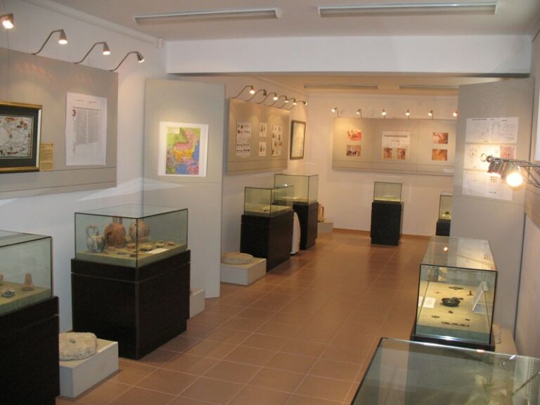
Historical Museum
Location: city of Kavarna, №1B „Chernomorska” Str.
Telephone: +359 570 8 21 50, +359570 8 23 27
Visiting hours: From Monday till Friday - from 08:00 till 12:00 and from 13:00 till 17:00
Website: www.kavarnamuseum.org
Ethnographic Complex
Location: city of Kavarna, № 16 „Sava Ganchev” Str.
Telephone: +359 570 8 50 17
Visiting hours: From Monday till Friday - from 08:00 till 12:00 and from 13:00 till 17:00
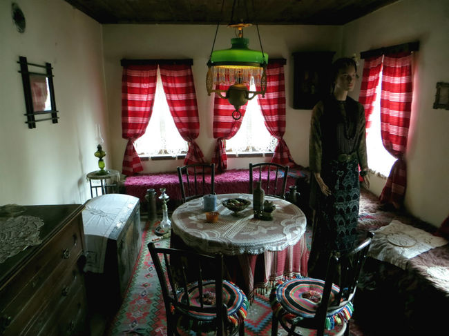
The Ethnographic Complex of Kavarna opened its doors for the very first time to visitors in 1984. It was built on the site of the first Bulgarian school, founded in 1869. It is consisted of four different zones - a museum, restored chehlarnitsa, lace workshop and an yard zone. The interior introduces to the visitors the typical urban life style of the late IX and early XX century. It reflects the characteristics of the basic ethnographic population in this region - Dobrudzhantsi, Gagauzes, Kotels.
Exposition „Dobrudzha and the Sea”
Location: city of Kavarna, №1B „Chernomorska” Str.
Visiting hoursе: From Monday till Friday - from 08:00 till 12:00 and from 13:00 till 17:00
Telephone: 0570 84288
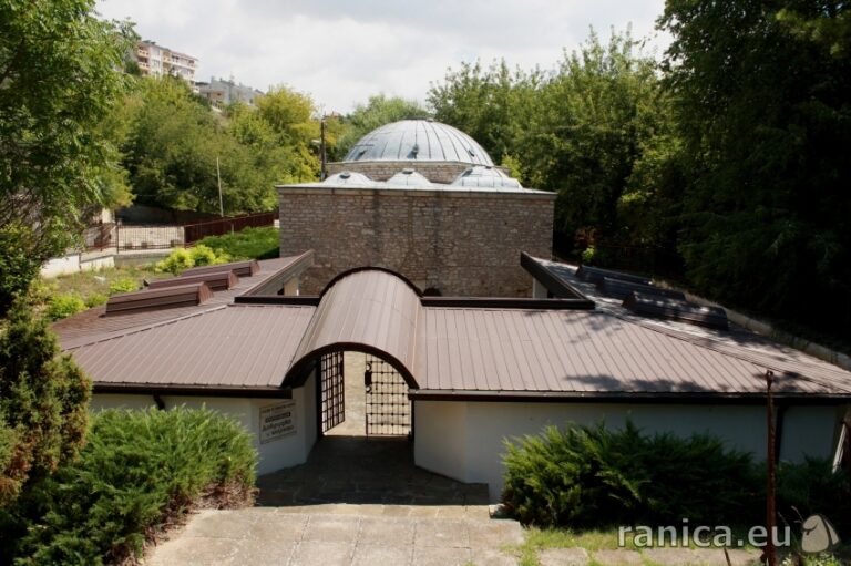
The exhibition is located in the restored and adapted for this purpose, late medieval bath /hamam/. Together with the beside situated large stone fountain, it shapes a picturesque architectural ensemble.
-
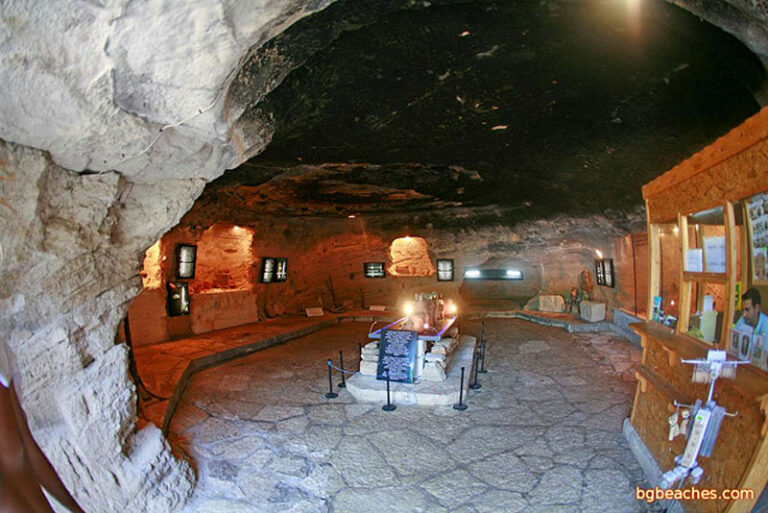
Museum at the cape Kaliakra
Visiting hoursе: 1 April – 31 October: 09:00 – 19:00 every day. The museum is not open for visitors in the winter time months.
Entrance Fee: adults – 3 BGN, kids – 1,50 BGN
Beseda (available in Bulgarian langage only) – 10 BGN
Chirakman Cape
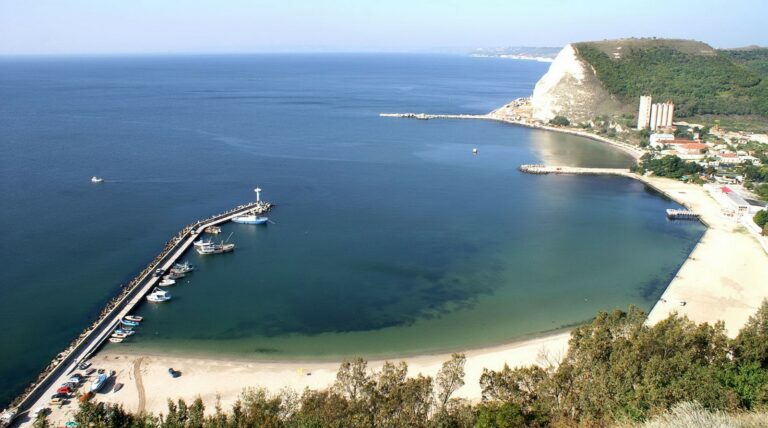
Cape Chirakman rises majestically over the Kavarna Bay. The name of the cape means torch and according to the historical sources of information, it served as a sea landmark. It is located in the south part of the city, 3 km. away from Kavarna and presents the beautiful finish of the lovely valley, above the harbor and the sea.
In ancient times, Chirakman used to be an impressive peninsula, famous with its importance for navigation. During the first millennium BC., here arises an acient village, known under the name of Bizone, which passes through a period of decline as a result of the military-political reasons and the catastrophic earthquake in first century BC. During the Roman era, the life in Bisone had recovered and the city became known economical and cultural center.
For more information, visit the local Historical Museum.
An impressive fact about the history of Chirakman is that there were found more than 70 different types of coins and a golden treasure in the neighboring hill, produced in the city of Bizone at the end of IV century BC. The found golden objects are a crown and a golden vessel with an image of a chariot with three horses and a lion statuette. All this proves that Bisone and cape of Chirakman were inhabited by rich Thracian aristocrats who left part of their impressive decorations throughout the area of Kavarna. One of the most interesting findings discovered on cape Chirakman is made of bone and represents an eagle who has grabbed in his nails a beautiful swan.
In the small bay at the bottom of cape Chirakman are situated the fishermen village with houses and many boats, the marina and the beach. The area offers excellent opportunities for practicing recreational tourism as well as extreme and alternative sports and tourism, yachting, parachuting, paragliding, etc.
The muddy waterfall near village of Balgarevo
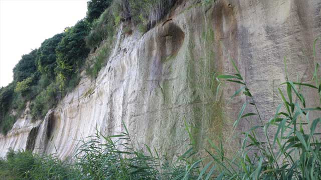
These are the newly formed mud waterfalls in Zelenka area, located near by Balgarevo village. They are formed as a result of the heavy rains in 2013. As a result of the rains, the strong underwaters began to descend from a height of 5-30 m. on the steep slope to the sea. Thus were formed the so-called mud waterfalls due to the worn soil.
The measured width is several hundred meters, while in dry weather are observed numerous small waterfalls with more or less water. During and after heavy rains, are noticed many “vadichiki” (separate flows of water) along the entire waterfall length. This might increase the danger of sliding bigger amounts of earth.
Historical centre “Ongala”
The center aims to promote the history of Bulgaria, the nations who had inhabited it and the cultural heritage they have bequeathed to the ones living here. There, through the narrated history, visualization and the live reenactments, will be awaken your interest to learn more about the history of ancient and modern inhabitants lived on our land. The museum has nine rooms, in each of them you can hear a different beseda related to the Bulgarian history from ancient times to today. Outside the halls, visitors can touch and make a picture with replicas of antique weapons and protective clothing. Lectures are conducted in 7 languages.
Feel free to open the GPS navigation to the beach
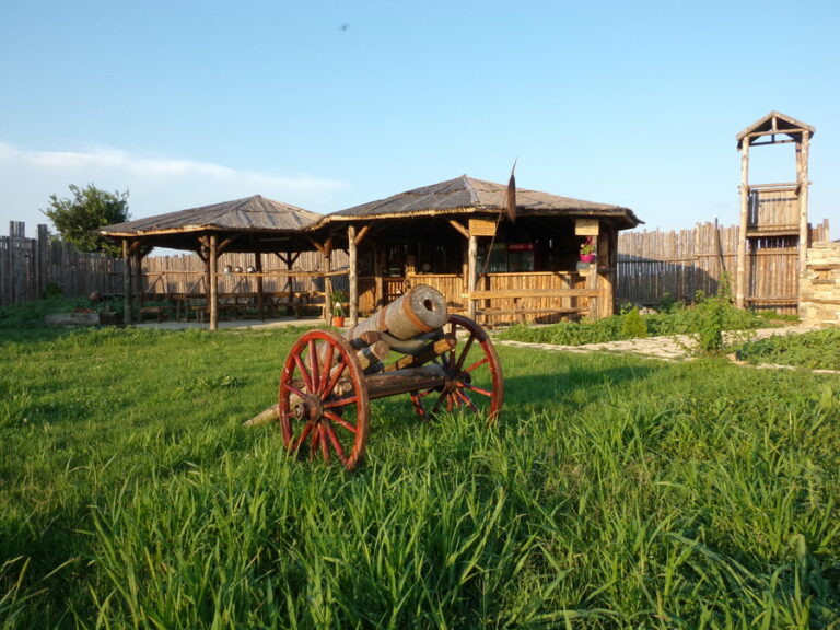
Bolata Bay
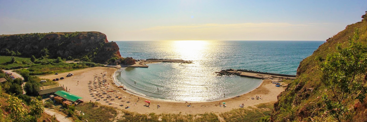
Bolata is the only reserve area in Bulgaria that includes a territorial and a sea area. Here you can observe interesting waterbirds, some of the species are included in the Red Book of Bulgaria (a list of endangered species in the country). Some of the birds that can be seen are ground birthed kingfishers, bittern, herons, grebes and ducks. Via Pontica passes from there & ndash; this is one of the main migration routes of migratory birds.
In the caves of Bolata were found remains of an ancient settlement and an evidence of life from 400 BC, as well as an Maltese Cross & ndash; a testament for the trading industry in the Second Bulgarian Kingdom with Venice and Genoa.
A steep trail, in the north, climbs to the top of the rock wall, by boasting magnificent views of the entire ravine. Only here can be seen in full cape Kaliakra.
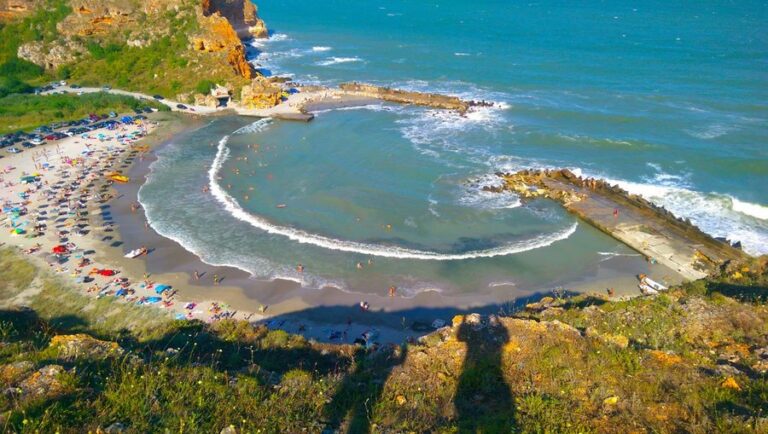
Kamen Bryag
Kamen Bryag village is located between the towns of Shabla and Kavarna. It is typical with its caves and rocky coves, all of them surrounded by stone blogs and vegetation. The area is famous for its initial beauty and romance. It is a perfect destination for the lovers of extreme sensations.The best sport climbers, from Bulgaria and abroad, annually cross the provocative difficult routes.
Feel free to open the GPS navigation to the beach
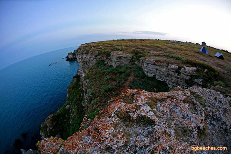
National Archaeological Reserve „Yailata”
Visiting time: 1 April – 31 October: 09:00 – 20:30 throughout the entire week. During the winter months November – March the reserve is closed for visitors.
Entrance Fee: adults – 3 BGN, kids – 1,50 BGN
For getting a guide,you should book it in advance nest to the Historical Museum - Kavarna.
The national reserve „Yailata” is located only 2 km. from the village of Kamen Bryag. Lots of archaelogical discoveries have been found there. On an area of 300 ha were found three necropolis carved into the rocks and 101 cave dwellings from the V century BC. The „Yailata” bay is located in between two sea terraces. It is believed that the gulf between them was used as a port in the past, as multiple anchors were found on the bottom. The fortress was built in the late V - early VI century AD, then it was destroyed, and later on- in the ninth century AD, a Bulgarian settlement was established around it. The reserve is included in the register of protected areas and protected areas of Bulgaria by Order of 23.08.2002, No.RD822.
Feel free to open the GPS navigation to the beach
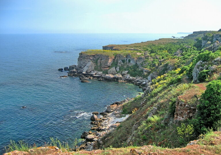
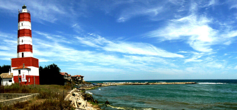
The Lighthouse of the Cape Shabla and the Shabla Tuzla
The lighthouse of Cape Shabla (know also as the small version of one of the seven wonders in the ancient world & ndash; the Pharos Lighthouse) is the oldest and highest one in the country & ndash; It is 32 meters high and operates even today. Few years ago the unique establishment celebrated its 150 birthday.
It is dyed in red and white and prevents the ships from colliding through the reef, which stretches nearly one sea mile away, and from getting stuck in the shallows between Cape Shabla and Tyulenovo. Its white light flashes three times on each 25 seconds and in clear weather it could be seen from 17 sea miles away.
An interesting fact is that there is a message for posterity, built-in the walls of the tower, more than 10 years ago. The guards’ message should be open in the year of 2056. It contains some data regarding the distance from the coast to the lighthouse, which should be compared with the one of 2056.
Feel free to open the GPS navigation to the beach
The region of Shabla Tuzla is popular with its healing sea mud that has a positive impact on diseases of the musculoskeletal system, cardiovascular, neurological, gynecological, skin and other diseases. In the area of Shabla Tuzla is located the Dobrudzha camping and the beach of Shabla Tuzla & ndash;,considered as one of the best beaches on the north coast.
Durankulak Lake
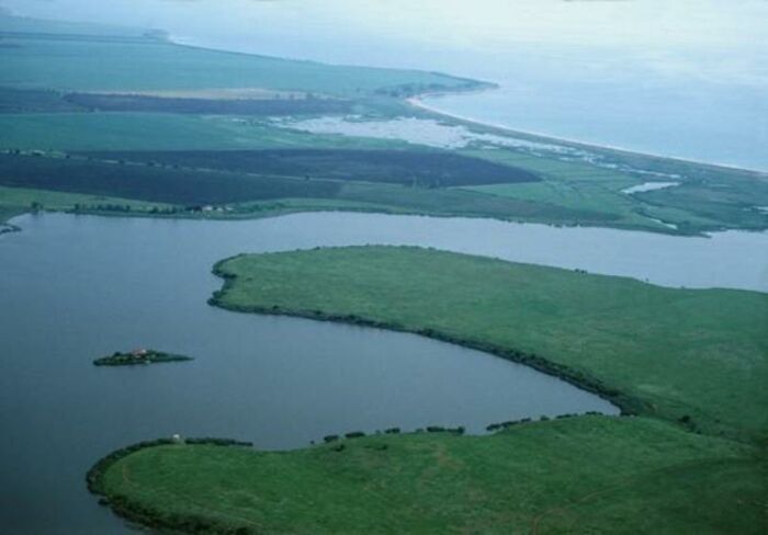
The protected area of Durankulak lake is located a kilometre away from the South East part of the village Durankulak. It is separated from the sea by sand lagune. Also known as the Eagle (Kartaliisko) lake or & ldquo;swamp& rdquo ;, called by the locals, it is not very deep and is more than two times longer rather than wide. All nature lovers should visit it, in order to observe some rare and endangered flora and fauna.
Feel free to open the GPS navigation to the beach
The historical island near Durankulak with the temple of Cybele
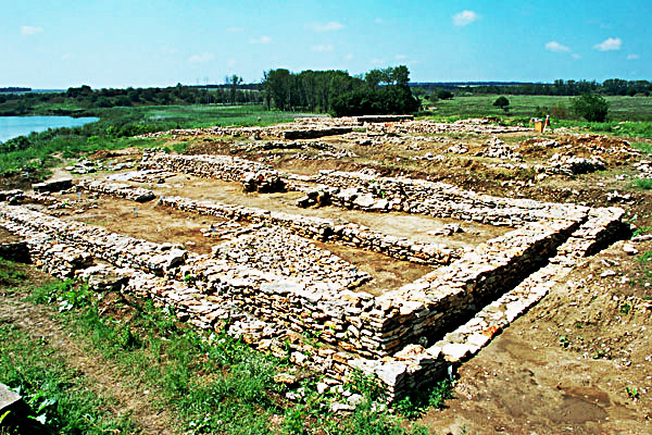
Two islands have formed in the waters of Durankulak lake. The bigger island (a peninsula in nowadays), with an area of 20 acres, is the oldest open air museum in Bulgaria. It is the only place in Europe, where could be found the cave shrine of the goddess Cybele and the Neolithic mound from 4600-4200 BC. There were found also traces of the oldest agricultural and stock breeding population of Dobrudja, a bearer of the prehistoric culture Hamangia.
The initial conservation of the archaeological remains is complete, and the island might be visit through the built wooden walkways and safe routes. In the archaeological park studios, the visitors and lovers of the past have the opportunity to get acquainted with the various prehistoric technology & ndash; how to make jewelry out of beads, how to make tools out of flint or pottery. Thus he can bring back home not only experience, but also a memory from the trip to the lake island and its ancient inhabitants.
Feel free to open the GPS navigation to the beach
Tyulenovo
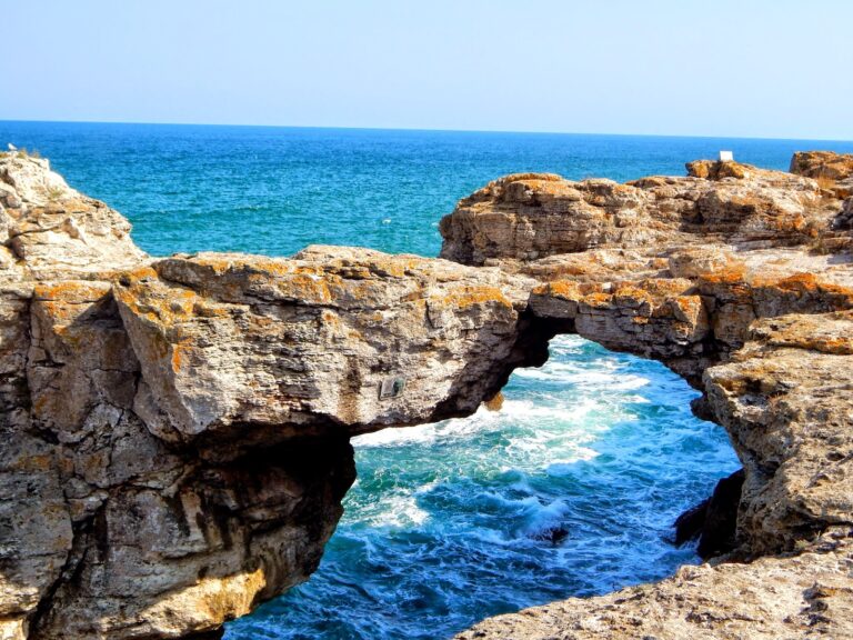
The village of Tyulenovo is famous for its beautiful high rocky cliffs, folded in numerous caves and interesting rock formations. This is a favorite destination of all keen on photography and diving. One of the most famous places is the rock arch in the southern part of the village. Besides its beautiful rock formations and caves, it could be also found in the nearby areas the Ashalaka and the Hole.
Feel free to open the GPS navigation to the beach
